Accessible urban spaces allow disabled individuals to leverage public services, enjoy equal opportunities, and maintain independence. Navigating inaccessible areas can be challenging and frustrating, potentially leading to a loss of autonomy and a sense of disempowerment. Enhancing technology platforms with adequate accessibility data supports disabled people's participation in economic activities, empowering them further.
Mapping technology and location-based products can be enriched with data to help individuals with disabilities (visual impairments, hearing loss, intellectual and physical disabilities, injuries and more), navigate and utilize urban environments. To create more inclusive apps and platforms, businesses require current and comprehensive accessibility data from the physical world. Many location-based businesses are already innovating in this space and striving to keep accessibility at the forefront. Geospatial data, such as up-to-date POI data, can supplement and accelerate these efforts.
How Geolancer can help capture real-world accessibility data
Our proprietary in-field data collection platform, Geolancer, can collect and report accessibility information on the ground. These datasets provide valuable information for creating inclusive platforms and spaces.
Our users (Geolancers) can contribute data on accessible entrances, ramps, elevators, and more. The app includes specific data fields tailored to disabled people, like wheelchair accessibility, Braille signage, auditory signals at pedestrian crossings, accessible restroom facilities and more custom attributes can be collected on-demand.
Geolancer enables users to pinpoint the location of accessibility features or obstacles, ensuring accurate data collection. Additionally, photos or videos of accessibility features or barriers offer visual evidence and additional context for the dataset (which can be extremely helpful for disabled individuals other than those with blindness).
Geolancer can also allow users with certain disabilities to collect data themselves, in exchange for crypto rewards, and share their first-hand experiences regarding the accessibility of various locations and businesses. This information will undoubtedly prove to be invaluable for the disabled community, empowering safe and comfortable navigation of the surrounding area.
Accessibility data Geolancer can collect
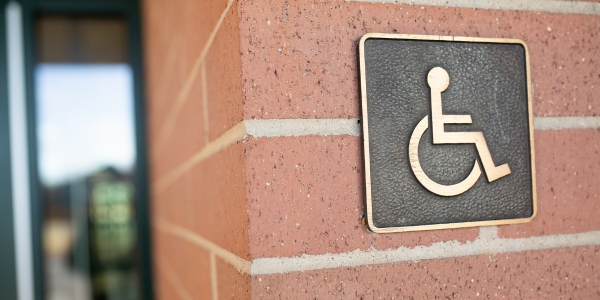
Wheelchair accessibility
.png?width=1920&height=500&name=Wheelchair%20accessiblity%20graphics%20(with%20captions).png)
Accessible parking
.png?width=1920&height=500&name=Accessible%20parking%20graphics%20(with%20captions).png)
Visual accessibility
.png?width=1920&height=500&name=Visual%20accessibility%20graphics%20(with%20captions).png)
Auditory accessibility
.png?width=1920&height=500&name=Auditory%20accessibility%20graphics%20(with%20captions).png)
Indoor navigation and layout
.png?width=1920&height=500&name=Indoor%20navigation%20and%20layout%20graphics%20(with%20captions).png)
Accessible public transportation.png?width=1920&height=500&name=Accessible%20public%20transportation%20graphics%20(with%20captions).png)