October 21, 2021 How to use location data in transportation and mobility Transportation companies need location-based intelligence to gauge demand, support operations,... Read More
September 29, 2021 Reducing Data Preparation Costs & Increasing ROI with Mobile Location Overlap Analysis The location data industry is using multiple sources of data with a varying degree of quality. This... Read More
August 4, 2021 User behaviour and POI data quality in Geolancer – Quadrant quarterly hackathon Earlier this year, we launched the public beta test of our proprietary POI collection and... Read More
July 26, 2021 Retail after the pandemic – Using POI data to revitalise the retail industry The Covid-19 pandemic and following global lockdowns were devastating for the retail industry.... Read More
July 1, 2021 Performing Extrapolation on Location Data to Derive Relevant Insights Location data is collected from multiple sources of varying quality GPS signals from mobile... Read More
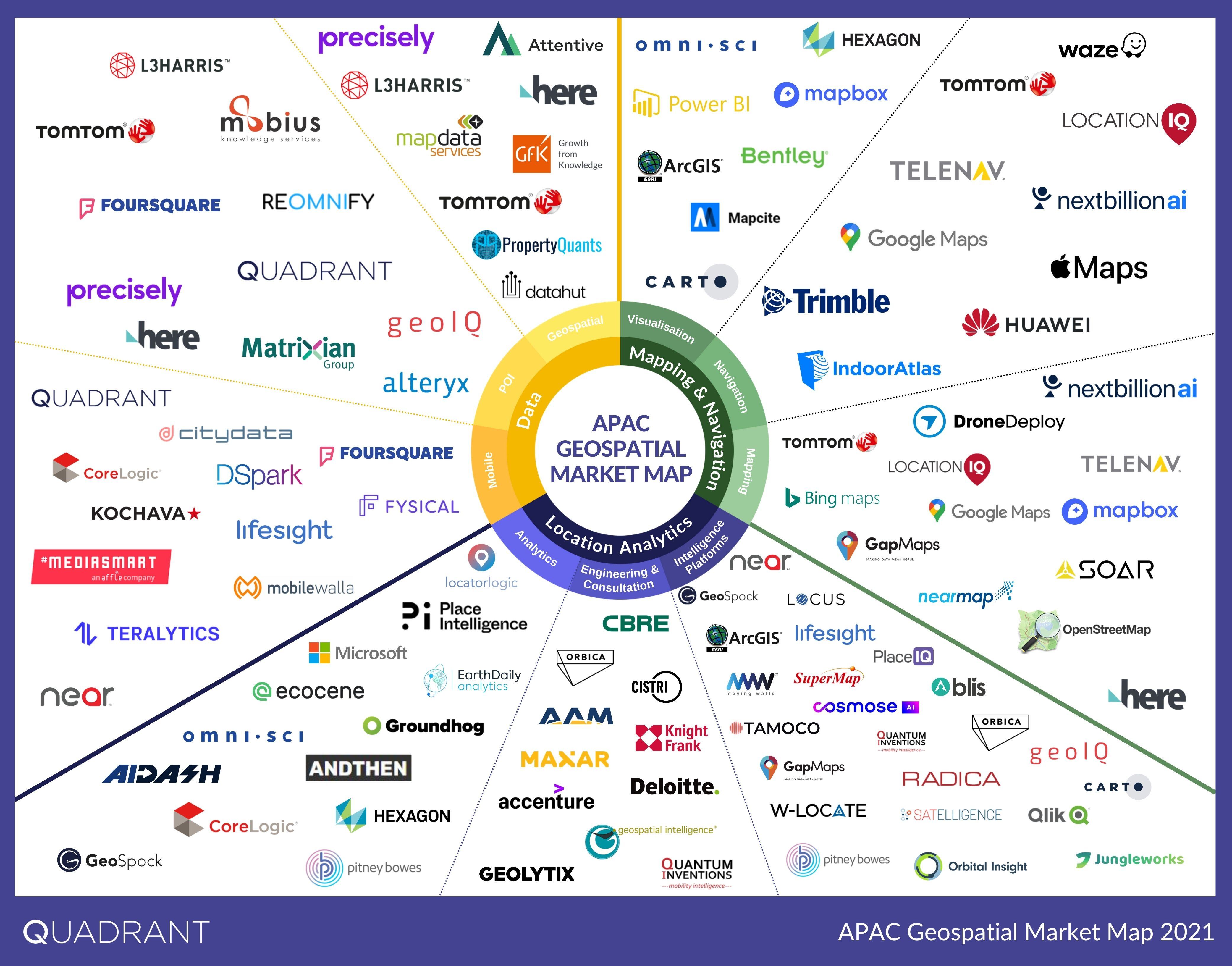
June 14, 2021 Geospatial Market Map for APAC - 2021 The intricate web of connected devices and applications produces a lot of location data. Used in... Read More
May 27, 2021 Common Problems With Location Data and How to Fix Them Geospatial data have the potential to uncover valuable insights about the physical world. It can be... Read More
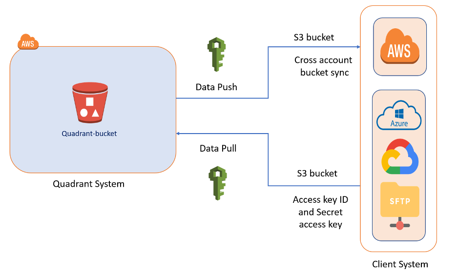
April 22, 2021 Methods of Data Delivery for Mobile Location Data One factor to consider while evaluating location data for purchase is data delivery. Storage costs... Read More
April 14, 2021 Buying POI Data: Best Practices for Vendor Selection High-quality Point-of-Interest (POI) data is the backbone of all location-based businesses and... Read More
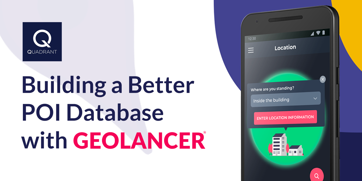
March 16, 2021 Building a Better POI Database with Geolancer Point-of-Interest (POI) data is critical in many sectors of the economy. Businesses and customers... Read More